Jim Reeves' Plane
Crash Site
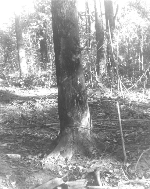
 This is the Jim Reeves crash scene. This picture was
taken a few days after the debris was removed in early August
1964. It was at the base of this tree that the nose of the plane
made contact with the ground, gouging out a crater six feet deep
(in the bottom foreground). Part of one of the wings wrapped
halfway around the tree (and you can see evidence of where the
bark was stripped and the tree scorched). The canopy of the tree
at the top was not disturbed, and closed up again after the plane
came through it vertically. Thus searchers flying overhead were
unable to see the crash from the air.
Many fans have visited what they thought was the crash
site, and some believe they've even found the exact tree. I know
a lot of people have attempted to pinpoint the location through
satellite maps online. Some folks apparently think they can just
view photos of the site and figure out where it was.
In order to be accurate about this for my book, I
have relied not only on interviews I've done with people who
were part of the search effort, but also talked with federal
authorities who participated in the official investigation. Most
importantly, I have reviewed contemporaneous and very detailed
notes they made about the debris field, with surveyor (or compass)
coordinates.
From doing this research, I know that very few fans
have actually identified the site correctly.
The bottom line to this is that Jim's plane went down
on PRIVATE PROPERTY, which is still overgrown with greenery and
hard to reach. In 1964, rescuers had to tear down part of a fence
to access it, and it is even more difficult now.
Putting a marker here that would be some sort of remembrance
for the average fans to view, would obviously be impractical.
You can't just go hiking through the brush in search of this
site without trespassing on private property.
Yet the scene is far enough away even from the closet
streets and highways that it would make no sense to erect a marker
along the roadways.
--Larry Jordan
|

